Hunstanton, Norfolk
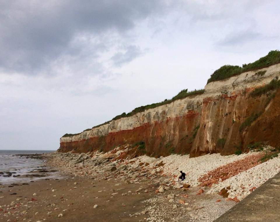 The cliffs at St Edmund's Point provide the most accessible natural outcrop of the solid geology beneath Norfolk around the Early to Late Cretaceous boundary, from roughly 100 million years ago.
Geological Field Guide from Hunstanton to Wells-next-the=Sea
Click on an image to see a large image in your default image viewer.
St Edmund's Point
On the northwest corner of Norfolk the cliffs display a striking section of Cretaceous rocks: Carstone (the brown rock at the cliff base and in the foreshore), the Hunstanton Formation (formerly known as the Red Chalk or Hunstanton Red Rock) only about a metre thick, sandwiched above the carstone and below the chalk, and the Ferriby Chalk at the top of the cliff, which is the oldest Chalk visible in Norfolk.
| Beach and cliffs. | St. Edmunds Point Hunstanton 23.4.2009 |
 DSCF0243.jpg |
| Beach and cliffs. | St. Edmunds Point Hunstanton 23.4.2009 |
 DSCF0244.jpg |
| Rock strata: brown Carstone the lower half of the cliff; red or pink Hunstanton Formation about 1 m thick above the Carstone; Ferrible Chalk (Upper Cretaceous) top third of the cliff. | St. Edmunds Point Hunstanton 23.4.2009 |
 DSCF0245.jpg |
| Rock strata: brown Carstone the lower half of the cliff; red or pink Hunstanton Formation about 1 m thick above the Carstone; Ferrible Chalk (Upper Cretaceous) top third of the cliff. | St. Edmunds Point Hunstanton 13.6.2018 |
 IMG_7254.jpg |
| Fallen blocks of the Hunstanton Formation and Ferriby Chalk. | St. Edmunds Point Hunstanton 23.4.2009 |
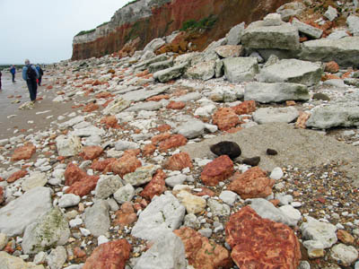 DSCF0251.jpg |
| Fallen blocks of the Hunstanton Formation and Ferriby Chalk. | St. Edmunds Point Hunstanton 23.4.2009 |
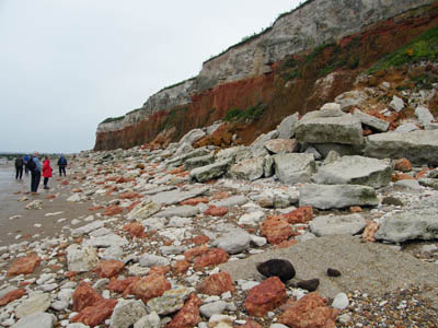 DSCF0252.jpg |
| Fallen blocks of the Carstone, Hunstanton Formation and Ferriby Chalk. | St. Edmunds Point Hunstanton 23.4.2009 |
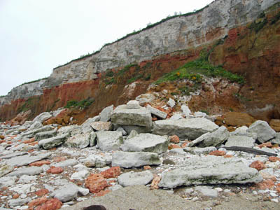 DSCF0253.jpg |
| Fallen blocks of the Carstone, Hunstanton Formation and Ferriby Chalk. | St. Edmunds Point Hunstanton 13.6.2018 |
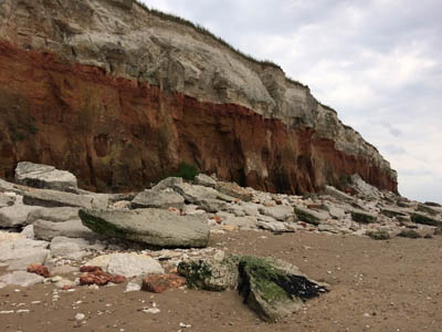 IMG_7263.jpg |
| Fallen blocks of the Carstone, Hunstanton Formation and Ferriby Chalk. | St. Edmunds Point Hunstanton 13.6.2018 |
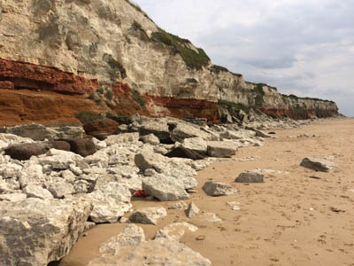 IMG_7253.jpg |
| Strata in the cliffs: Carstone (base), Hunstanton Formation (middle cliff) and Ferriby Chalk (upper cliff). | St. Edmunds Point Hunstanton 13.6.2018 |
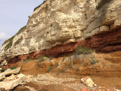 IMG_7250.jpg |
| Outcrop the Carstone, Hunstanton Formation and Ferriby Chalk. | St. Edmunds Point Hunstanton 23.4.2009 |
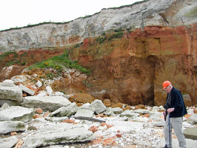 DSCF0254.jpg |
| Outcrop the Carstone, Hunstanton Formation and Ferriby Chalk. | St. Edmunds Point Hunstanton 23.4.2009 |
 DSCF0255.jpg |
| Fallen blocks of the Carstone, Hunstanton Formation and Ferriby Chalk. | St. Edmunds Point Hunstanton 23.4.2009 |
 DSCF0264.jpg |
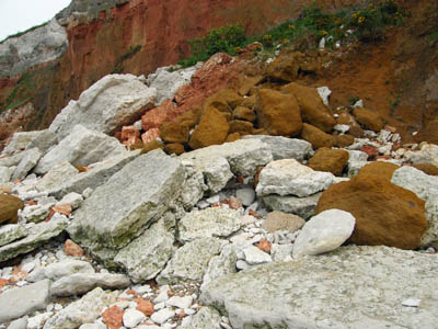
| Fallen blocks of the Carstone, Hunstanton Formation and Ferriby Chalk. | St. Edmunds Point Hunstanton 23.4.2009 |
 DSCF0265.jpg |
| Fallen blocks of the Carstone, Hunstanton Formation and Ferriby Chalk. | St. Edmunds Point Hunstanton 13.6.2018 |
 IMG_7253.jpg |
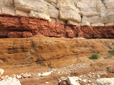
| The Hunstanton Formation (centre), Carstone (below) and Ferriby Chalk (above). | St. Edmunds Point Hunstanton 13.6.2018 |
 IMG_7249.jpg |
| Boulders of Carstone and Ferriby Chalk. | St. Edmunds Point Hunstanton 13.6.2018 |
 IMG_7255.jpg |
| The lighthouse is perilously close to the eroding cliff. | St. Edmunds Point Hunstanton 13.6.2018 |
 IMG_7256.jpg |
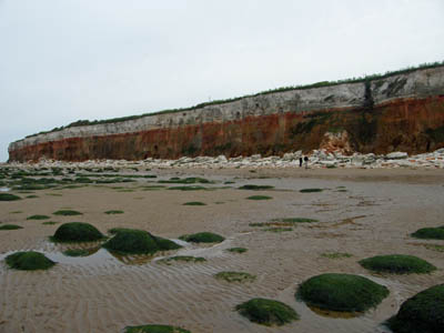
| The junction at the base of the Ferriby Chalk dips gently to the north and eastwards, bringing it gradually down to beach level around the corner in the distance. | St. Edmunds Point Hunstanton 23.4.2009 |
 DSCF0281.jpg |
| Through the centre of the photograph runs the Hunstanton Formation, a metre or so of reddened chalk, which is a condensed rock coloured by iron oxide. | St. Edmunds Point Hunstanton 23.4.2009 |
 DSCF0282.jpg |
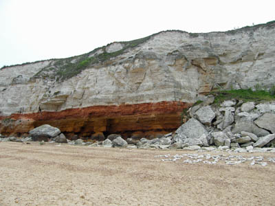
| The cliff shows a clear dip of the rock to the left (northwards and eastwards). | St. Edmunds Point Hunstanton 23.4.2009 |
 DSCF0312.jpg |
| The joints in the Carstone at the base of the cliff are exploited by the sea and form shallow caves. The reddish pink Hunstanton Formation rests on the Carstone and the Ferribly Chalk forms the upper two thirds of the cliff. | St. Edmunds Point Hunstanton 23.4.2009 |
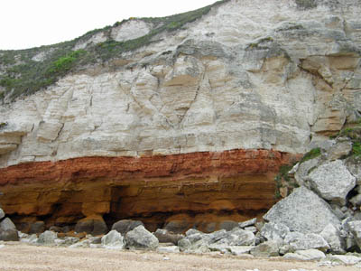 DSCF0313.jpg |
| The joints in the Carstone at the base of the cliff are exploited by the sea and form shallow caves. The reddish pink Hunstanton Formation rests on the Carstone and the Ferribly Chalk forms the upper two thirds of the cliff. | St. Edmunds Point Hunstanton 23.4.2009 |
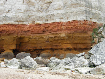 DSCF0314.jpg |
| The regional joint pattern within the Carstone is exposed on the foreshore. The brown Carstone is covered in green seaweed. | St. Edmunds Point Hunstanton 23.4.2009 |
 DSCF0242.jpg |
| Rectilinear joints in the Carstone are widened by marine action and rounded to form these curious bun-shaped outcrops. The brown Carstone is covered in green seaweed. | St. Edmunds Point Hunstanton 23.4.2009 |
 DSCF0276.jpg |
| Rectilinear joints in the Carstone are widened by marine action and rounded to form these curious bun-shaped outcrops. The brown Carstone is covered in green seaweed. | St. Edmunds Point Hunstanton 23.4.2009 |
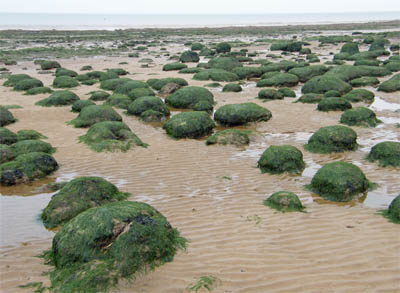 DSCF0278.jpg |
| Rectilinear joints in the Carstone are widened by marine action and rounded to form these curious bun-shaped outcrops. The brown Carstone is covered in green seaweed. | St. Edmunds Point Hunstanton 23.4.2009 |
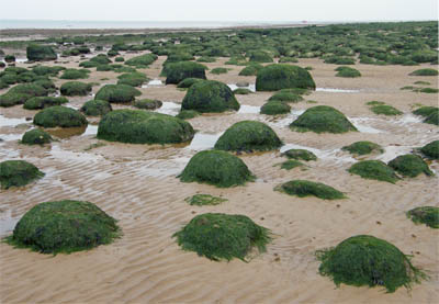 DSCF0279.jpg |
| Rectilinear joints in the Carstone are widened by marine action and rounded to form these curious bun-shaped outcrops. The brown Carstone is covered in green seaweed. | St. Edmunds Point Hunstanton 23.4.2009 |
 DSCF0280.jpg |
| Rectilinear joints in the Carstone are widened by marine action and rounded to form these curious bun-shaped outcrops. | St. Edmunds Point Hunstanton 23.4.2009 |
 DSCF0281.jpg |
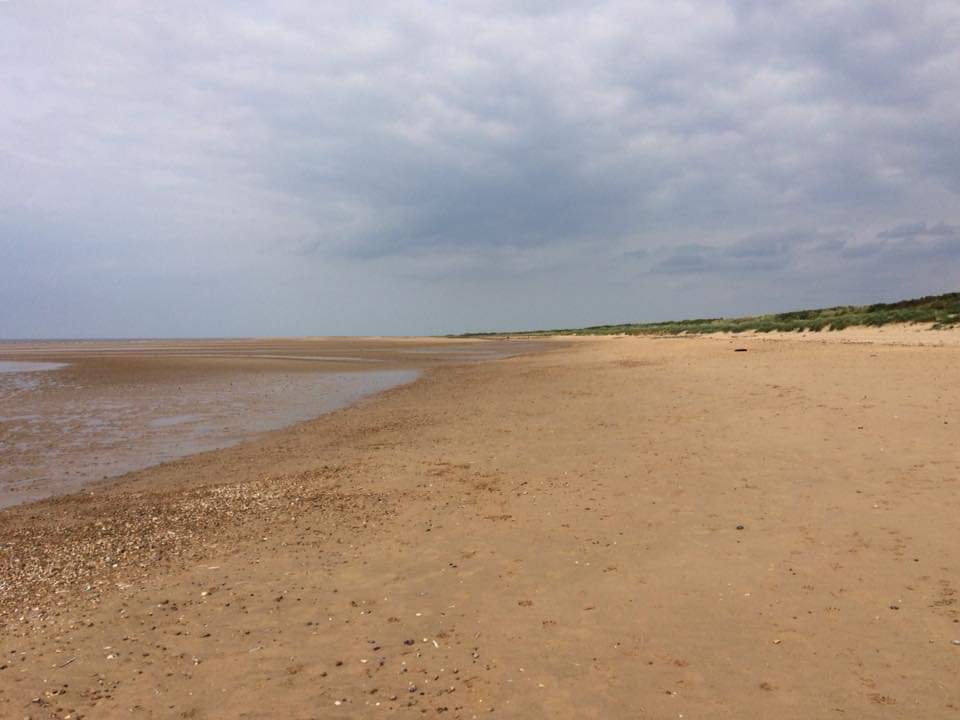
| The beach northeast of Old Hunstanton. The eastward dip of the strata and the topography combine and there is no outcrop of strata here. The coastline eastwards to Weybourne is characterised by dunes, shingle barrier spits and islands, salt marsh and grazing marsh. | Old Hunstanton 13.6.2018 |
 FB_IMG_1670738229772.jpg |
More pictures to come...
Martin Warren, The Northfolk Project
8.12.2022